 Iwakuni Sato-no-Eki
 日本語
日本語 English
 Iwakuni Sato-no-Eki
 日本語
日本語 English
 The Road of Walking
Introducing the fun of walking around Yamashiro, including hiking and mountain climbing. There are quite a few attractions to the area, such as strolling around Kintai Bridge and the surrounding Shiroyama, enjoying the scenery of the season, a view from the top of the mountain, and a journey through the history that has been handed down to the region.
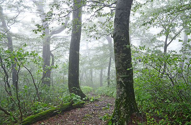

It's located in the Jakuchigawa, which originates from the highest mountain in Yamaguchi Prefecture, Mt. Jakuchi (1337m above sea level). "The Inubou kyo Gorge" and "the Ryugatake Gorge" are collectively called "the Jyakuchi kyo Gorge". There are "Goryu no taki" waterfalls and "Inumodoshi no taki" waterfalls which are members of Japan's top 100 waterfalls. In the mountain stream, a beautiful landscape is formed by a lot of strangely shaped rocks and rare rocks. Today it's one of the 100 famous clear waters.
Location: Usa, Nishikimachi, Iwakuni
access: 40 minutes by car from the Chugoku Expressway Muikaichi IC
Taking the municipal bus ride from Nishikigawaseiryusen Nishiki-cho Station, and getting off at Jakuchikyo Iriguchi.
It is a collective term for five waterfalls: "Ryuzu", "Ryumon", "Hakuryu", "Toryu", and "Ryubi" that fall in the Jakuchikyo gorge. And it's a member of Japan's top 100 waterfalls.
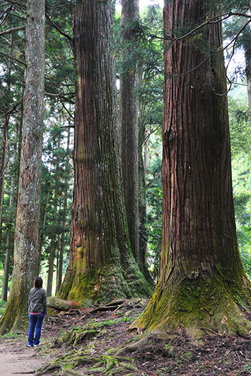
"Usa no Osugi" is over 1,000 years old in the precincts of "Usa Hachimangu Shrine". There is a cedar giant tree group, and it has become a natural monument designated by the prefecture.
Location: 1542 Usa, Nishikimachi, Iwakuni
Access: 15 minutes by car from Chugoku Expressway Yoshiwa IC
bus from Nishikimachi Station on the Nishikigawa Seiryu Line, 5 minutes on foot from the Jakuchikyo Iriguchi

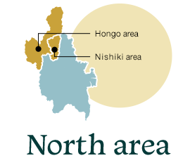
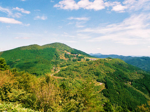
1109m above sea level. From the top of the mountain, you can see the West Chugoku Mountains, and when the weather is fine, a view of the Seto Inland Sea and Shikoku is possible... The magnet rock at the top is famous as a power spot.
Location: Rakansan, Akigake, Miwamachi, Iwakuni
Access: 75 minutes by car from Chugoku Expressway Muikaichi IC

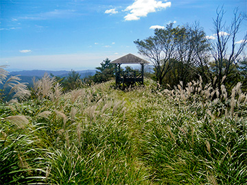
962m above sea level. The view of Rakan Plateau and Mt. Rakan is beautiful.
Location: Usa, Nishikimachi, Iwakuni
Access: 75 minutes by car from the Chugoku Expressway Muikaichi IC
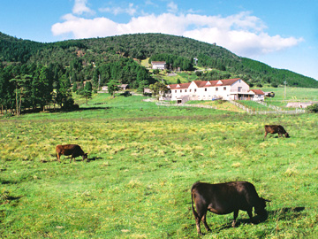
About 900m above sea level. It's a plateau surrounded by Mt. Rakan and Mt. Hokke. A campsite is available. It's also popular for short climbing courses to Mt. Rakan and Mt. Hokke and so is the forest bathing and views.
Location: Rakansan, Hongoumachi, Iwakuni
Access: 75 minutes by car from Chugoku Expressway Muikaichi IC
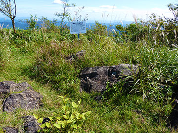
At the summit of Mt. Rakan, there are peridotites that have undergone contact metamorphism due to crustal deformation. Peridotite has a strong magnetic force, so it will point in the wrong direction when you bring a compass closer.

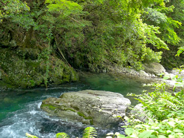
About 800 years ago, the princess of Genji whom Heike caught as a hostage, and the local youth fell in love here. And their love was achieved across a huge difference in status. A legend is told.
Location: Kitani, Nishikimachi, Iwakuni
Access: 40 minutes by car from the Chugoku Expressway Muikaichi IC
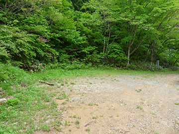
The Heike clan - which lost the battle of Dannoura, hid themselves in Mt. Bahungadake, but since they were found by Genji, they escaped to the mountain valley of Kitani and took on farming. So here it's called the "Heikeyashiki ato" which means "Heike residence ruins".
Location: Hirose, nishikimachi, Iwakuni
Access: 40 minutes by car from the Chugoku Expressway Muikaichi IC
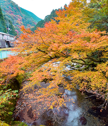
It is a gorge carved in the Kitanigawa with the history of Genpei, and it's also called the "Momiji Gorge". Waterfalls such as "Shikaochi no taki", streams, and depths are overlapping, and water flow through the strangely shaped rocks, and the beauty of the autumn leaves is quite exceptional.
Location: Kitani, Nishikimachi, Iwakuni
Access: 40 minutes by car from the Chugoku Expressway Muikaichi IC
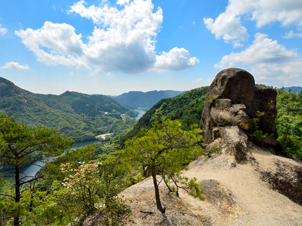
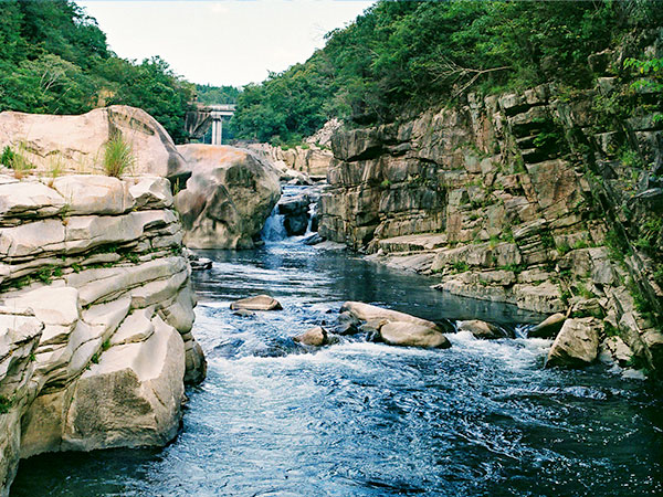
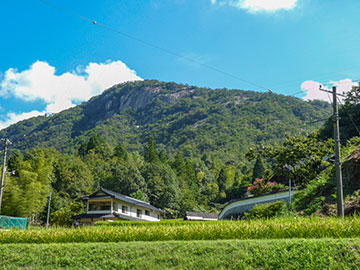
458m above sea level. It is called Shiratakiyama because its rock surface shines white and water flows like a waterfall. From the top, you can look down at Lake Yasaka with a panoramic view. Around 1180, the Heike family which was chased by Yoshinaka Kiso escaped to Yamashiro and built a castle on Mt. Shirataki, at Ganne. Some had knowledge of grafting, and brought a large chestnut branch from Aki Saeki-gun and grafted them. Since then, Ganne has become a large chestnut production center.
Location: Ganne, Miwamachi, Iwakuni
Access: 45 minutes by car from Sanyo Expressway Iwakuni IC
It's upstream of the Ozegawa which flows east of Mt. Shirataki. There are rare strangely shaped rocks and so-called monster stones such as Jyakuiiwa, Byobuiwa, and Kameiwa. And walking along the promenade is one sure way of enjoying the beauty of nature.
Location: Daisaburo Miwamachi, Iwakuni
TEL: 0827-95-1123
Access: 30 minutes by car from Otake IC, Sanyo Expressway
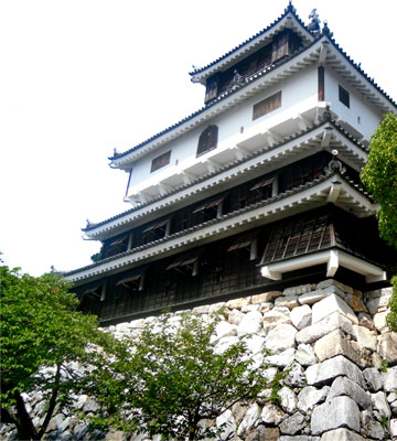

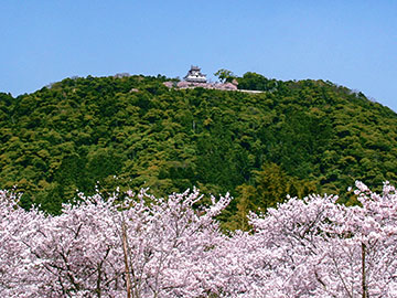
300.4m above sea level. The beginning of the Edo period, Iwakuni Castle here was demolished by decree-"Ikkoku ichijo rei"*, and since then, the forests mainly composed of evergreen broad-leaved trees have not been joined by people for nearly 400 years. So it has been designated as a state-owned nature conservation forest.
*. A decree that only one castle, where Landlord resides or is a government office, is allowed in one province and all other castles must be abandoned.
Location: Yokoyama, Iwakuni
Access: 10 minutes by car from Sanyo Expressway Iwakuni IC
From JR Iwakuni Station, taking a bus bound for JR Shin-Iwakuni Station and getting off at Kintaikyo Bus Stop for about 18 minutes, then 10 minutes by walk.
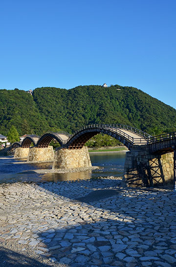
Wooden Five arches span the 200 meter width of the Nishikigawa. Founded in 1673 by Hiroyoshi Kikkawa, former Iwakuni lord. And it has been passed through the subsequent outflow and reconstruction. It's now popular as the citizen's symbol.
Location: Iwakuni 1-chome, Iwakuni
Fee: 300 yen for adults 150 yen for children
Access: 7 minutes by car from Sanyo Expressway Iwakuni IC
20 minutes by bus from JR Iwakuni Station to Shin-Iwakuni Station, walk to Kintaikyo Bridge 5 minutes
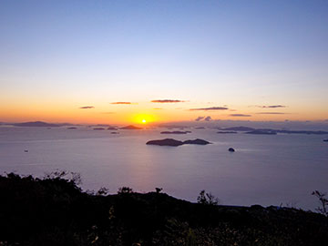
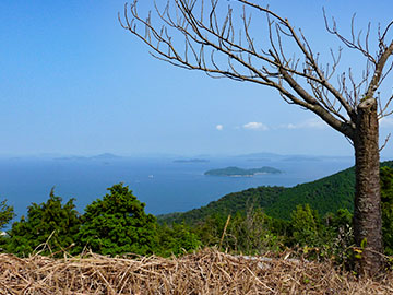
A 360-degree panoramic view from the Mt. Zenitsubo summit observatory, overlooking the Shikoku Mountains and the Seto Inland Sea. On a sunny day you can also see Kyushu-the major bottom island part of Japan. From Mt. Zenitsubo, there is a mountain road joining onto Mt.Daishougun. And at the top of the mountain is Kirimine Shrine, which prospered long time ago.
Location: Yuumachi, Iwakuni
Access: By car - 5 minutes from JR Yuu Station
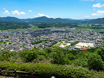
240m above sea level. It's well known for the battle of Kurakake many years ago. It is popular for mountaineering, and it has a world's view of the Kuga Basin. From the observatory you can get a good look.
Location: Kurakake Kugamachi, Iwakuni
Access: 15 minutes by car from Sanyo Expressway Kuga IC
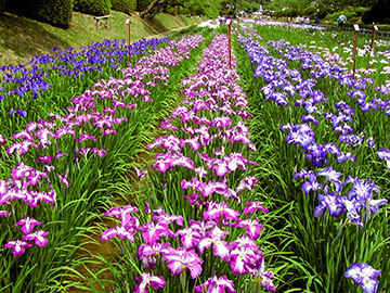
The site of the Iwakuni lord- Kikkawa family, is home to the vast garden, dotted with buildings and fountains such as Kinunkaku, Kagawa-ke nagayamon(House Gate), Chokokan... Beautiful flowers are enjoyed one season after the next...
Location: Yokoyama 2, Iwakuni
Access: 7 minutes by car from Sanyo Expressway Iwakuni IC
18 minutes by bus from JR Iwakuni Station to Shin Iwakuni Station, 6 minutes on foot from Kintai Bridge